Lapadilla
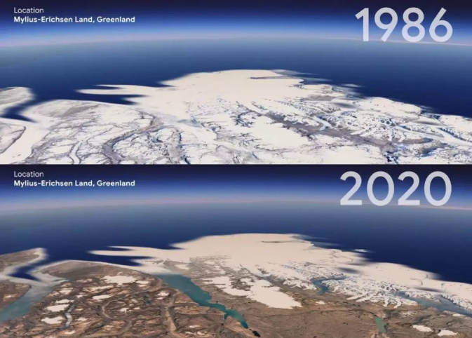
The popular Google Earth project, which shows the three-dimensional representation of the Earth based on satellite imagery, includes a new temporary layer that could see the evolution of the planet over the past 37 years as of this Thursday.
The new function of the cartographic service uses 24 million satellite images taken over the past four decades, which the project owner named the Google 4-D product because it adds time to three space dimensions.
“Through Google Earth ‘Timelaps’, we provide the user with a clear picture of how our planet is changing. An image that shows not only the problems, but also the solutions,” a company spokesman told reporters including Efe.
Any web user who wants to can access the new functionality through g.co/Timelapse by clicking on the ship’s rudder icon and selecting the “Timelapse” option.
Google’s idea is that researchers, governments, corporations and non – profit organizations around the world could use this free tool to monitor the effects of the climate crisis.
The 24 million images used in “TimeLaps” are from 1984 to 2020, and they represent quadrillion pixels, which took more than 2 million hours to process.
To develop the product, Mountain View (California, USA) used data provided to the public by the US government and the European Union. EFE


:quality(85)/cloudfront-us-east-1.images.arcpublishing.com/infobae/M7XCYNL6P5FQZAB33N6QXI4QTA.jpg)